Tornado Warning Siren Information
Like Us on Facebook for Severe Weather & Winter Weather Updates
We're still working on it!
Seriously.. we are! No coffee breaks either..
Seriously.. we are! No coffee breaks either..
Help! - How to Navigate & Understand Our Website
First time visitor? Wondering how to read the radar, Severe Outlook maps and how to understand the weather terms that we use, what it means and how it works? Wonder no longer - you've come to the right place! Below you will find everything you need to know about reading the radars, understanding the maps, above, beyond and everything in between on our website.
The Radars
When rain, snow, flooding or tornadoes threaten our state, we want to help you stay on top of the action! That's why we offer FIVE Doppler radar imagery sites around the state, covering every inch of Tennessee. But what's the use of a radar to you if you don't know how to read it correctly? How would you be able to tell heavy rain from a tornado? What about a narrow band of rain from a gust front? Spotty showers from a flock of birds? (yes, weather radars can even sense birds!)
What is a Weather Radar?
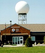
Reading and Understanding Doppler Radar Imagery
What do all of the different colors mean?
| dBZ | Rainrate (in/hr) |
|---|---|
| 65 | 16+ |
| 60 | 8.00 |
| 55 | 4.00 |
| 52 | 2.50 |
| 47 | 1.25 |
| 41 | 0.50 |
| 36 | 0.25 |
| 30 | 0.10 |
| 20 | Trace |
The Earth isn't flat!
We figured that out over 2356 years ago!Seriously though, ever wondered why radar imagery only goes for about a 50-mile radius? The farther out the radar signal goes, the
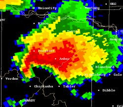
The "Hook Echo"
The "Squall Line"
The "Bow Echo"
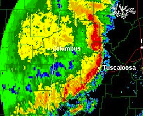
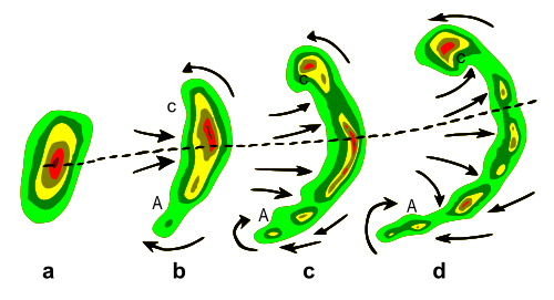
You've probably heard this term used on some weather station - the "bow echo" (as it is commonly referred to). Bow echoes are usually associated with "squall lines" or lines of strong and severe thunderstorms. They can cover a single county or an entire state, and can last for 3-6 hours. These "bow echoes" tend to develop when strong wind shear, or low-level high wind gusts are dominant in a particular area of a storm. Bow echoes usually bring damaging winds and heavy rain, and have the ability to spawn off tornadoes - sometimes even violent tornadoes. Straight-line winds are commonly produced from bowing squall lines. Strong bow echoes are sometimes referred to as "derechos" and have the ability to cause massive and widespread damage. You can find this storm feature on radar imagery by looking for an outward bulge on the front side of a squall line, or long band of strong-to-severe thunderstorms.
"Radar Clutter"
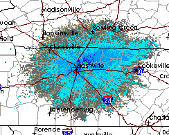
"Radar Clutter" (as it is commonly called) is usually shown on radar data maps as very light rain.. which it isn't - at least not 99% of the time. This "clutter" can be a variety of things: birds, flocks of birds, insects, leaves in the air, tall trees, low-flying airplanes, helicopters, and even Joe's kite that he flies every Sunday morning at 10AM.
Site Announcements
If something important comes up, and we feel that you should know the second that you visit our site, we will post it in our site's Announcements section. The Announcements section appears at the top of every single page on our website. This can include recent site updates, pre-disaster and post-disaster information, important news from the National Weather Service, FEMA, or any other reputable source, we will post it as quickly as possible to the Announcements section.
Severe Outlook Announcements
Not only do we post the latest news and updates to the Announcements section, we also regularly update the Severe Outlook status for today, tomorrow and the next day. If only one day is indicated to pose a threat of thunderstorms and/or severe weather, we will only post the Severe Outlook update for that day. If there happens to be a threat of thunderstorms and/or severe weather for all three days, then a separate announcement will be posted for each day.Each Severe Outlook announcement is not just a line of text, but it is also a link. Click the text for the corresponding Severe Outlook announcement and you will be directed to a page with the latest Severe Outlook map for that day.


